

12 boreholes map Port Vila’s ground conditions after earthquake
September 24, 2026 10:56 pm | Posted in Business News | Share now TwitterFacebook
By Nicholas Mwai.
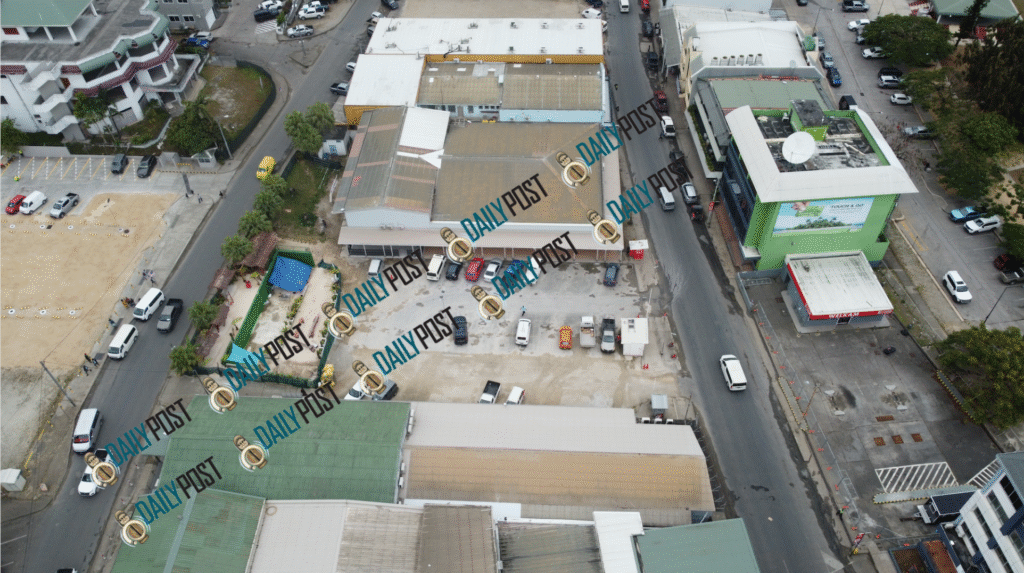
Twelve boreholes drilled up to 30 metres beneath Port Vila’s Central Business District (CBD) have helped geotechnical experts better understand what lies beneath the city and how different ground conditions could affect future construction.
The investigations formed part of a New Zealand-funded geotechnical assessment supporting Port Vila’s earthquake recovery and rebuilding efforts.
Government Project Manager for Recovery, Nik Regenvanu, said the boreholes were among several geotechnical tools used by Tonkin + Taylor to develop guidance for rebuilding the capital following the 17 December 2024 earthquake.
“There are a number of geotechnical tools that were used by Tonkin + Taylor to come up with the geotechnical guidance handbook and the portal that will support both regulators and developers in how we assess how we’re going to rebuild, looking at what’s under the ground,” Regenvanu said.
Chris Hartnett, Infrastructure Project Manager of the New Zealand High Commission, explained that the geotechnical assessment was funded by New Zealand and was designed to better classify what is underneath the CBD.
“The geotechnical assessment was a part of a New Zealand funding package for the earthquake recovery and looked towards experiences in Christchurch that Nik mentioned, for classifying what is underneath the ground,” Hartnett said.
Hartnett said much of what lies beneath Port Vila had previously been difficult to determine, particularly in areas where the earthquake caused significant changes to the ground.
“It’s very much an unknown,” he said, pointing to different hazards that emerged after the earthquake, including areas around the former Jungle Cafe and the lowered section of the street around the new Pikinini Bar and the former NBV building.
“All of those things require quite technical investigations to actually understand why that ground has gone down and what effects that means for future buildings,” Hartnett said.
The 12 boreholes were drilled to 30 metres, allowing geotechnical experts to examine the materials beneath the city.
“The 12 boreholes mentioned, that was one tool that the geotechnical experts used to have a look underneath the ground down to 30 metres,” Hartnett said.
Staff from the Department of Geology and Mines also observed the drilling process and the material brought to the surface.
Hartnett said the investigation helped determine whether the material beneath the city was coral or reclamation fill.
“We know that that bay in Port Vila used to have lots of small bays and it’s now been covered over by seawall and concrete,” he said.
“So it’s hard to tell what’s under the ground, but by drilling down, analysing the logs and then putting them onto a map, the experts were then able to understand, well, we can build a picture now of what’s under the ground.”
The boreholes were not the only investigation carried out.
Hartnett said seismic testing was also undertaken along roads in the CBD to help experts understand how the ground could respond during future earthquakes.
The testing involved sensors placed along the streets while shockwaves were generated through the ground.
“That sends out shockwaves and shows how the ground’s going to react in future earthquakes,” Hartnett said.
He said the information helped experts build a model of the CBD and run seismic models to examine how the ground could shake in future earthquakes.
Hartnett said the investigations have now provided a much clearer picture of Port Vila’s underground conditions.
“We know a lot more now than we did before,” he said.
The study identified four different ground zones across the CBD study area, which stretches from Moorings to the Grand Hotel area, up the hill towards Joint Court and covers much of the areas where major demolitions occurred.
One of the key findings was the presence of deep marine sediments and reclamation fill around areas such as the former NBV building.
Hartnett explained that parts of the CBD sit over an area that was once underwater and has been progressively filled.
“So it’s actually an underwater underground sea cliff that’s being filled up with marine sediments and reclamation fill over time,” he said.
This means some areas contain coral while others contain softer sediments.
“So you’ve got coral on one side, soft sediment on one side. So understandably when the ground shakes, that soft sediment sunk,” Hartnett said.
Further up the hill, the ground becomes shallower and contains more coral rock, which Hartnett described as firmer ground.
Higher again, the investigations identified Efate pumice, which he described as the underlying bedrock forming the foundation of the island.
The information gathered from the boreholes and other investigations has been incorporated into a map and geotechnical tools designed to support future development.
Hartnett said the findings have been mapped so that the ground conditions can be better understood across the CBD.
Regenvanu said the information will be used as a guide alongside existing planning and building regulations.
“The technical advice to us is that there’s nowhere in Port Vila that’s unbuildable,” Regenvanu said, referring to advice from geotechnical experts Tonkin + Taylor.
He stressed, however, that the geotechnical findings are a guide and must be used together with other regulatory tools, including the Port Vila City Council (PVCC) Zoning and Development Control Plan and the National Building Code.
The geotechnical information will also be made available through an online portal where users can select a lease and view information about the ground conditions in that area.
Regenvanu said the portal can provide information on the geotechnical composition of a site and recommendations for additional testing where required.
He said the tools are intended for developers, existing building owners, PVCC and other stakeholders.
The findings show that the earthquake did not affect all parts of the CBD in the same way because the ground beneath the city is not uniform.
The information is now being used to help guide Port Vila’s rebuilding with a better understanding of the ground beneath its buildings and infrastructure.